Natural History
Geography
Cultural
History
Plants &
Animals
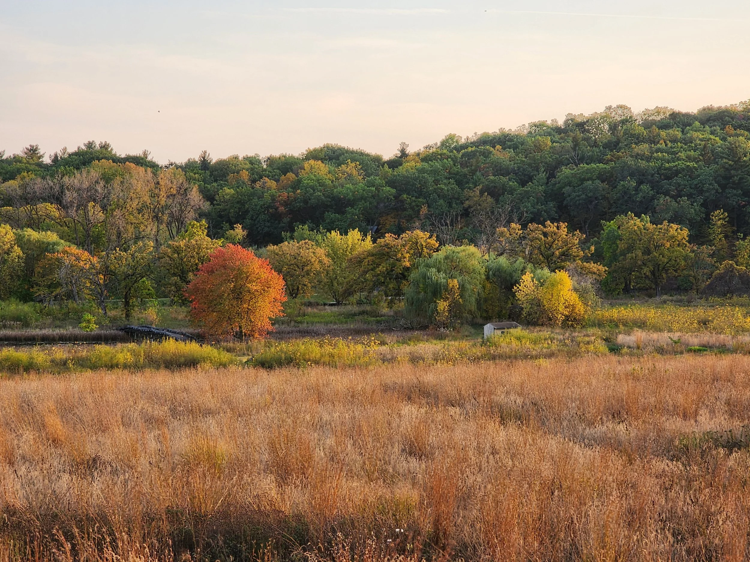
The Lower Sugar River Watershed is rich in ecological diversity, supporting a wide range of habitats, wildlife, and natural resources. Explore below to learn the unique facets of our watershed.
Geography
What is Geography?
A scientific definition of geography refers to the study of the physical features of the earth and its atmosphere, and of human activity as it affects and is affected by these, including the distribution of populations and resources, land use, and industries. What this means is that as human beings, we play an important role in the past, present, and future geography of the Lower Sugar River Watershed! We are part of the living story of the watershed's geography and our decisions today will impact the health and well-being of the land, water, and people in the watershed for generations to come.
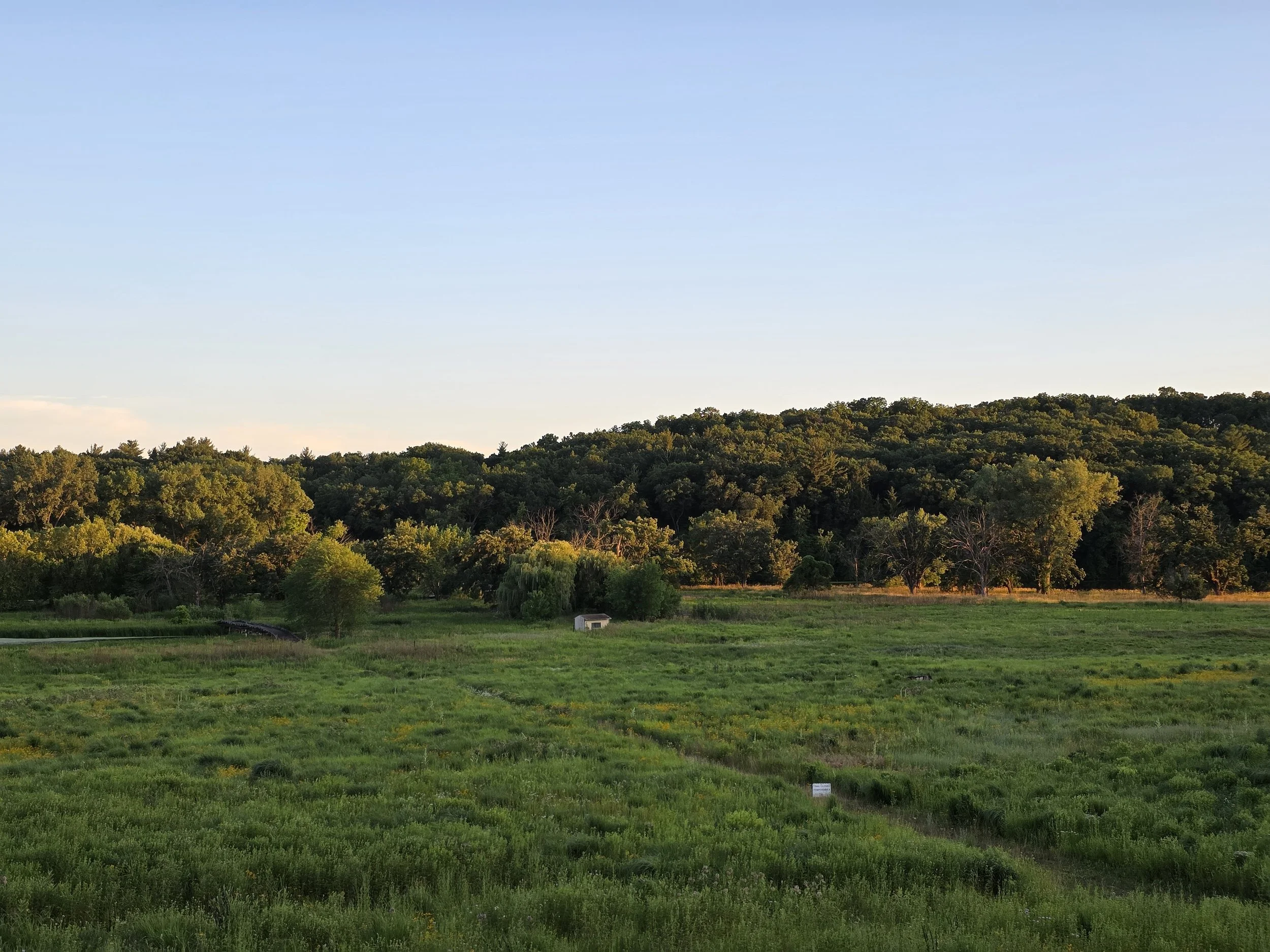
The Lower Sugar River Watershed – The Lower Sugar River Watershed (see map) covers 192,617 acres (301 square miles). It begins near Albany, WI. in the north, extends west to the outskirts of Monroe, east to Orfordville, and south to Shirland, IL where it flows into the Pecatonica River, crossing the boundaries of four counties and two states. The watershed covers portions of Green and Rock Counties in Wisconsin and Stephenson and Winnebago Counties in Illinois. The Lower Sugar River Watershed is composed of the Sugar River and several subwatersheds. The Lower Sugar River, as with the majority of the Sugar River basin, is largely rural in nature with 79 percent of the land use within the watershed consisting of agricultural land. The remaining land use in the watershed is a matrix of forests (8%), developed lands (6%), wetlands (5%), shrublands (1%), grasslands (1%), barren lands (0.1%), and water (0.4%).
Subwatersheds – The Lower Sugar River can be divided into 13 subwatersheds that range in water quality from impaired to Outstanding and Exceptional Resource Waters. One focus of the LSRWA is to improve the quality of the impaired subwatersheds, and monitoring work for this effort has already begun through our Citizen Science programs.
LSRW Natural Areas – A number of natural areas are found across the Lower Sugar River Watershed. Wisconsin’s Department of Natural Resources (WDNR) manages the Avon Bottoms Wildlife Area, Avon Bottoms State Natural Area, and Sugar River State Trail. The University of Wisconsin owns several sites designated as State Natural Areas, including Abraham’s Woods and Oliver Prairie. The WDNR manages Ward/Schwartz Decatur Woods, which is also a State Natural Area. The Sugar River Floodplain Forest is recognized by the Wisconsin Wetlands Association in its Wetland Gems™ program. In Illinois, Winnebago County Forest Preserve District manages the Sugar River Forest Preserve, Sugar River-Alder Forest Preserve, and Colored Sands Forest Preserve. Additional natural areas are protected through the work of private landholders, and a number of not-for-profit organizations such as the Natural Land Institute, The Prairie Enthusiasts, and Groundswell Conservancy among others.
Cultural History
The Rich Cultural History of the Lower Sugar River Valley
Rivers and streams have always drawn people for travel, commerce, food, and living sites, and the Sugar River is no different. This area has provided settlement for immigrants from Europe, Indigenous cultures including the Potawatomie and Ho-Chunk people, and before that Woodland mound-building cultures. The tributaries that feed the Sugar River throughout the watershed have helped shape the land for many uses.
Early History: 12,000 B.C. Through the 1800's A.D.
Phillip Millhouse, a noted local archeologist and historian, has done extensive research into the history of the Native American cultures that populated our region starting as far back as 12,000 B.C. His report, "Native American People in the Lower Sugar River Valley: 12,000 Years Ago to the Present," takes us on a fascinating journey through changing weather patterns, tribal migrations, different Native American communities, cultures, and traditions, as well as the arrival and ultimate dominance of the European settlers. Please take the time to read this wonderful and important record—as it not only provides a valuable window into our past but gives us clues as to how we may best restore and preserve our precious lands and water resources so future generations can read our story with pride and respect.
Modern Cultural History of the Lower Sugar River Valley
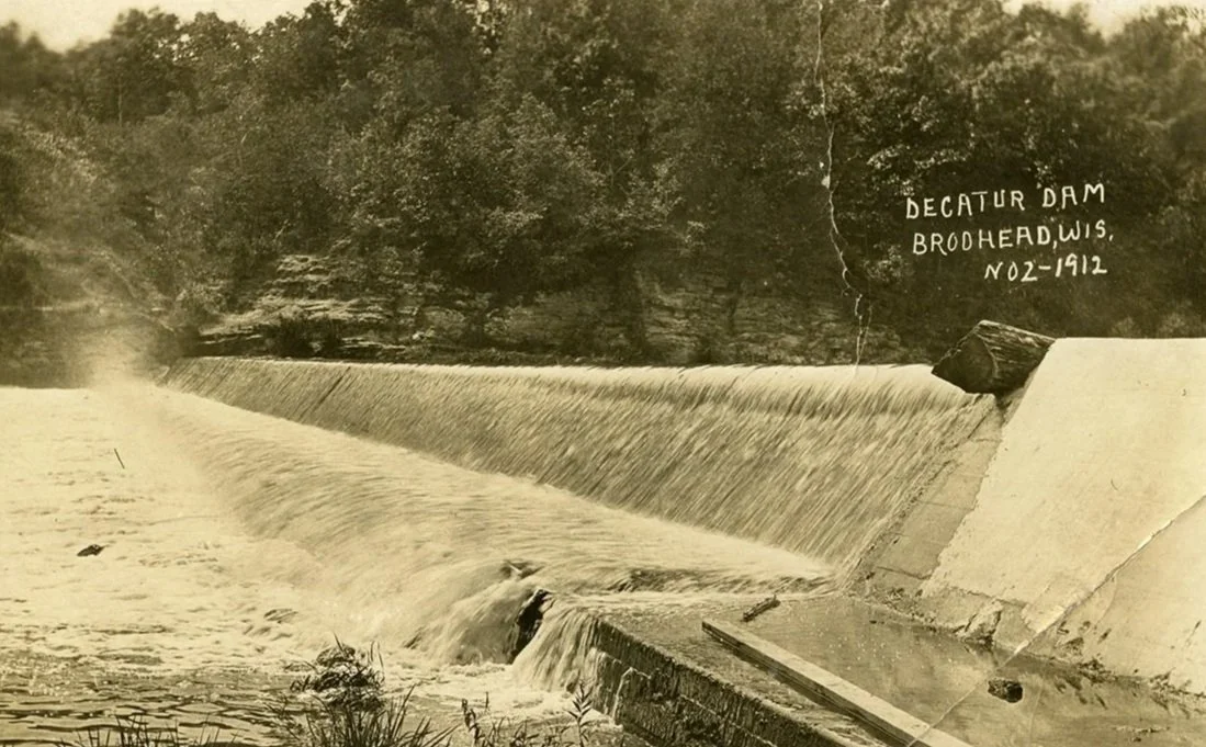
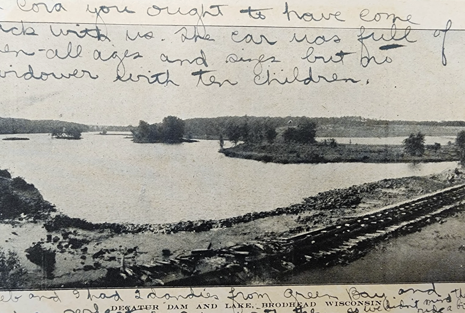
Agriculture, both row crop and livestock, is now a major land use throughout the watershed. The towns of Orfordville, Brodhead, and Albany in Wisconsin, and Durand, and Lake Summerset in Illinois are all included inside the watershed. Just downstream of Durand, near Shirland, IL, the Sugar River joins the Pecatonica River, ultimately joining the Rock River, and then flowing into the Mississippi on a lazy downward journey to the Gulf of Mexico.
Many people don't know that in the early 1900s, there was a pearl rush on the Sugar River! It all started when a perfect pearl was found inside a mussel taken from the Sugar River in Albany, WI. At this time pearls were to the aristocratic class what diamonds are today. Perfect pearls were rarer than fine diamonds, however, because they are created by living creatures. Freshwater pearls, formed when an irritant like sand is lodged inside the shell of a mussel, are often oblong and misshapen. Jewelers would hold a strand of pearls for years until the correct size of a perfectly round pearl was found to complete the piece. Teardrop-shaped pearls were used as highlights on sets of pearls. A strand of pearls that originally came from the Sugar River is housed with the rest of the Crown Jewels in the Tower of London today. A town south of the watershed, but included in this pearl rush, was renamed Pearl City in honor of the valuable pearl found in a mussel there.
Mussels were important for humbler reasons as well. Before plastics, mussel shells with their pearl-like interiors were collected to punch out buttons for fancy clothing. Of course, most people wore wooden, bone, or horn buttons on their everyday clothing. Middens or collections of spent mussel shells can be found along the shores of many waterways, the Sugar River included.
If you have some interesting facts about the history of our region, please share it! You can use our form below, or send us an email at info@lsrwa.org.
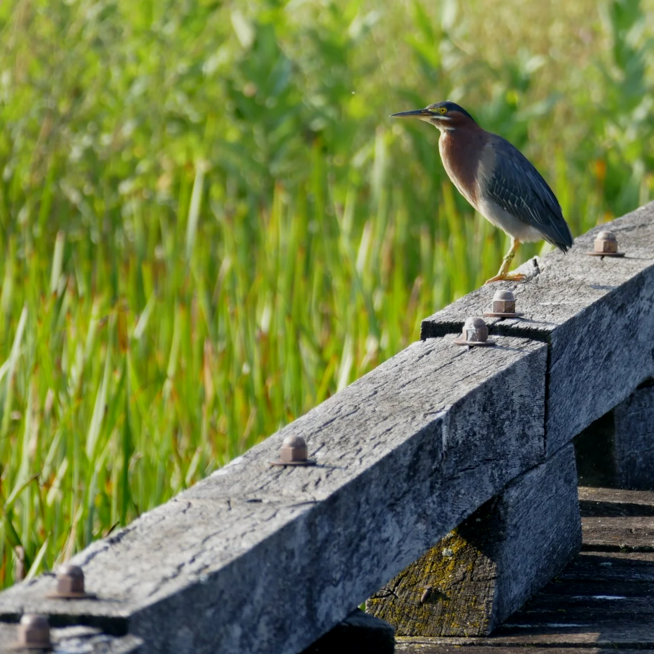
Plants & Animals
Diverse Plant & Animal Communities Support a Healthy Watershed
Since the dawn of life on earth, our natural world has been in a state of continual evolution and change. Natural disasters, climate change, and the actions of human inhabitants have led to mass extinctions, large-scale migrations, and the rise and fall of species across our planet. All of these actions impact the plant and animal communities that exist within watersheds.
In more recent times, the land around the Sugar River watersheds that our local Native American tribes knew were drastically changed by European emigrants who settled in their midst and turned the immense stretches of prairie and forested land to agriculture use. In modern times, many of us still don’t fully realize the impact of our actions on our natural world and plant and animal communities. Nor do we realize that those actions have multiple and far-reaching consequences in ways we never anticipated.
Our natural world exists in community. Even in the smallest ecosystem, plant and animal communities are interdependent and need each other for survival. In watersheds, plant and animal communities are intrinsically bound together. When habitat is altered or destroyed, the plants and animals associated with that habitat are forced to adapt, move to a new habitat, or die off.
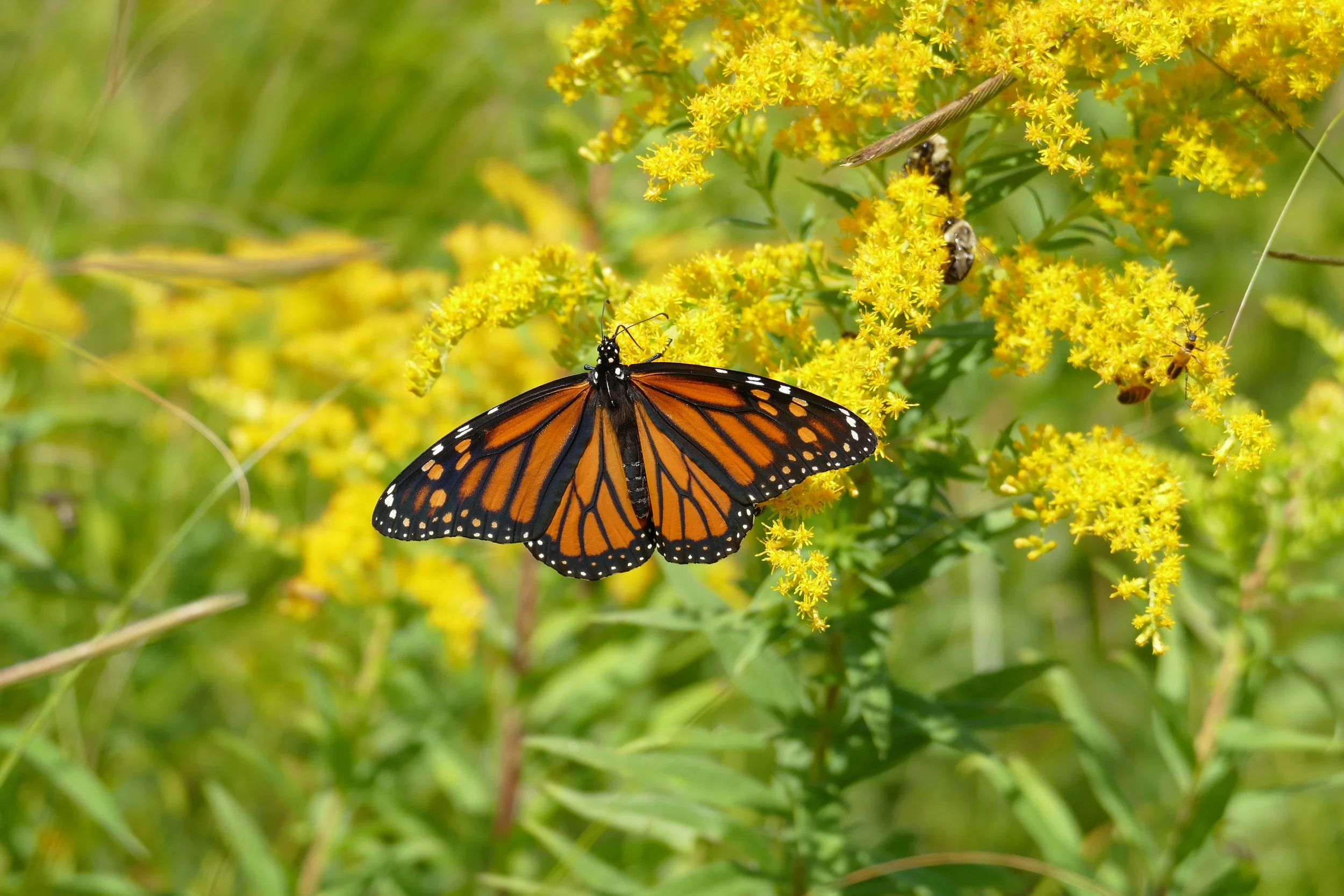
A good example is the monarch butterfly habitat. Monarchs must have milkweed on which to lay their eggs because the hatched larvae only eat milkweed. If the milkweed is killed by roadside spraying or removed for any reason, monarch butterfly populations suffer. Another example is when predators such as wolves, coyotes, and birds of prey are killed off, their intended victims tend to overpopulate their habitat, devour and destroy their plant communities, and become nuisances. The balance is broken and recovery is difficult.
Many problems within watersheds with invasive species of plants and animals can be traced to the introduction of plants and animals not native to our country. Think zebra mussels, Asian carp, nutria, python, emerald ash borer, gypsy moth, dandelion, garlic mustard, the European elm bark beetle, dame's rocket, Japenese honeysuckle and purple loosestrife to name a few. The common thread is that they have no natural checks to maintain balance in their populations.
Maintaining a balance between plant and animal communities is all about maintaining a well-functioning, healthy watershed. Many plant and animal communities in local streams, rivers, and lakes are suffering from excessive algae growth. Runoff from agriculture producers, lawns, city streets and county roads, septic systems, and sewage treatment plants is rich in phosphorus and nitrogen. Too often, it ends up being washed into our streams, rivers, and lakes. When the algae dies, the water’s oxygen is depleted in the decaying process. The lack of oxygen in the water causes many fish and macroinvertebrates (small animals without backbones) to struggle and die, leaving a “dead zone” that no longer supports a healthy and balanced plant and animal community.
The LSRWA has a volunteer water quality monitoring program that trains local citizens how to collect data from designated monitoring sites throughout the watershed. Information is collected for six important water quality criteria: temperature, water transparency, dissolved oxygen levels, macroinvertebrate numbers and types, habitat assessment, and stream flow. As data is gathered and analyzed, it gives us a benchmark of overall water quality in the various sections of our watershed, how that may impact our plant and animal communities, and forms the basis for restoration and remediation efforts. This is exciting and rewarding work that is going on in watersheds across the state and country. For more information, go to our Programs section, or go to Wisconsin's Citizen-Based Water Monitoring Network.
This is just one of the many ways that the LSRWA is working to ensure that the watershed has healthy and balanced ecosystems that support clean water, animal diversity, healthy soils, and year-round enjoyment of our precious natural resources.
Exploring the watershed is the best way to see first-hand what’s really going on. Get involved!